

The small community of Hankerton is fortunate to be surrounded by beautiful walks. To the east of the village lie the Cloatley Meadows and numerous village footpaths enable walkers to enjoy circular walks through the fields and through the small woodlands and copses at all times of the year.
Of particular interest is The Wiltshire Wildlife Trust’s reserve of Cloatley Meadows. Walking in The Cloatley Meadows is a delight in the months of May, June and July. Alarmingly, 97% of the Uk’s wildflower meadows have been lost since WW11. Flower-rich meadows, unspoilt countryside and woodlands have been destroyed and species-rich grassland now covers only 1% of the UK’s land. We are fortunate in Hankerton: we have an area of outstanding natural beauty within minutes of Holy Cross Church in the centre of the village.
Footpath maps are posted in the porch of Holy Cross Church in the centre of the village and in the Village Bus Stop at the junction of Cloatley Road and the Minety Road. The footpaths have been well maintained over the years and are clearly signed. Many walks can be devised, particularly as knowledge of the footpaths and bridleways is assimilated. The following five walks have been mapped and documented to assist with rambling in the village during the changing year. Enjoy!
There are five walks listed here. Click on the map to see a full size image. Click on the PDF to download it and print it.
 Walk 1 – A circular walk from Holy Cross Church via pasture, arable land and village lanes. ¾ ml. PDF : WALK No 1
 Walk 2 – Over mainly arable land west of the village, with distant views from the first section, and returning along the Hankerton-Crudwell lane. 3¼ mls. PDF : WALK No 2
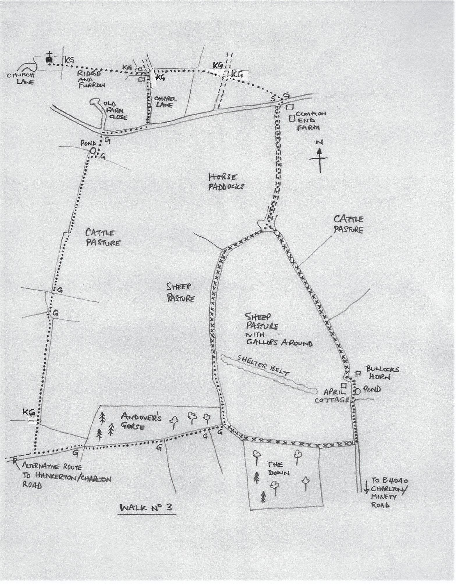 Walk 3 – A circular walk on pasture with adjacent woodland and elevated views of Hankerton. 2½ mls. PDF : WALK No 3
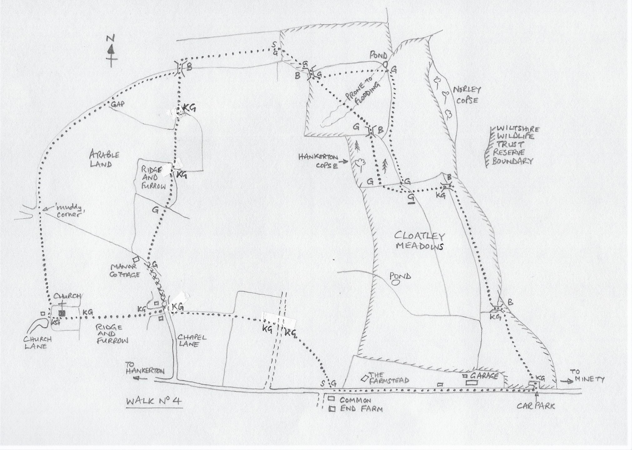 Walk 4 – A circular walk over arable land and pasture to Wiltshire Wildlife Trust reserve, Cloatley Meadows. 2½ mls. PDF : WALK No 4
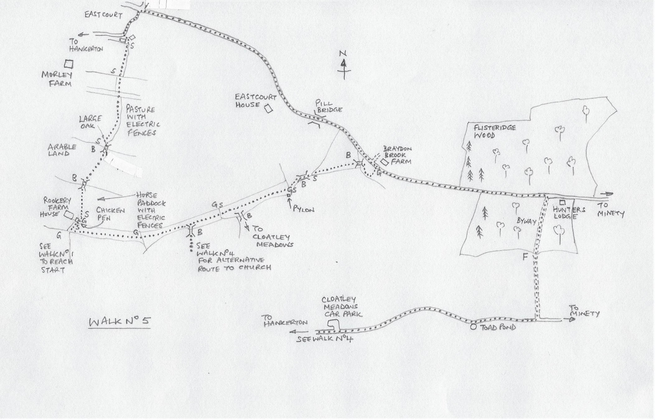 Walk 5 – Across horse paddocks and arable land to Eastcourt, a quiet lane to Flisteridge Wood, a byway via a ford to Cloatley Road and return to church. 5½ mls. PDF : WALK No 5
KEY TO MAPS, AND NOTES
FP – footpath
G – gate
KG – kissing gate
S – stile
B – bridge
CG – cattle grid
F – ford
…… route of walk on rights of way
xxxx route of walk on permissive paths
Maps are not to scale
Distances are approximate
Stout, waterproof footwear is recommended for all walks
On Walk 4 you may have to climb over a locked gate and on Walk 5 you will cross a 3 yd wide ford, with water up to a foot deep
There are minor inaccuracies in some maps where stiles have been replaced by kissing gates
